The Chairman of Lands and Forestry Committee of Parliament, Mr Francis Manu-Adabor, has underscored the need for the country to combine geospatial technologies with advocacies towards the fight against illegal mining.
According to him, this would enable the country to locate and quantify the devastation of its natural resources as a result of illegal mining and other devastating activities.
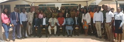
Mr Manu-Adabor said these at the launch of the Ghana Geospatial Society (GGS) in Accra Wednesday on the theme “Managing our Natural Resources through Geospatial Intelligence.”
The GGS is made up of seven working groups namely Geo-Social Sciences, Geo-Health and Science and Statistics, Geo-Environmental Natural Resources, Geo-Surveying, Geospatial Utilities and Engineering, Geospatial Security and the Geospatial Information Technology.

It is also made up of four Executive Committee members and seven Planning and Sponsorship Committee members.
Some of its roles are to disseminate information on advancements of the profession and establish a platform for collaboration through seminars.
Geospatial refers to location-based information, and any technology that may be used to access such information is a geospatial technology, including the widely utilised Global Navigation Satellite Systems and remote sensing.
“The use of geospatial technologies is by far the most efficient for mapping and would offer the country’s inventory of resources cheaper and easier to manage,” Mr Manu-Adabor said.
He explained that the country would benefit from the use of geospatial technologies and intelligences in the areas of land reclamation, crop yields analysis, livelihood analysis, food security analysis and property and degraded lands analysis.
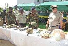
Mr Manu-Adabor noted that geospatial mapping and analysis of hot spots areas using geospatial technologies and intelligence would help highlight the potential risk of illegal mining and other devastating activities on the sustainability of natural resources in line with the Sustainable Development Goal 12.2.
He, therefore, called on inhabitants in the hot spot areas to appreciate the level of devastation caused by the illegal mining activities
On his part, the Deputy Minister of Transport, Mr Fredrick Obeng Adom, said “through geospatial intelligence, we get to understand natural resource management in a better way and enables us efficiently carryout most of these task which has been otherwise impossible.”
He further indicated that “geospatial intelligence and natural resource management is a collaboration to preserve nature and secure the earth for the present and future.”
Mr Adom also pledged government’s support for the society saying “we are ever ready to partner with you in carrying out our operations.”
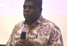
The Director of Technology and Innovation at the Ghana Water Company Limited (GWCL), Dr Richard Appiah Otoo, bemoaned the attitude of individuals in society such as indiscriminate dumping of solid and liquid waste and its impact on the earth.
He, therefore, called on the public to eschew such attitude and help save the environment from further degradation.
The President of GSS, Mr Michael Nyoagbe, in an interview with the Ghanaian Times after the launch emphasised on the need for the country to make use of geospatial technologies.
He further underscored the importance of engaging the youth in geospatial intelligence saying “We have to develop the interest of the youth in geospatial intelligence and the GGS will work towards that.”
BY BENJAMIN ARCTON-TETTEY & RHODA AMPONSAH